Flood modelling for Risk analysis and damage mitigation
Introduction
Bangkok faces a "perfect storm" of flooding drivers: intense "rain bombs" (exceeding 100mm/hour), land subsidence of 1–2 cm annually, and an outdated drainage system often clogged by debris. While the city's infrastructure is designed for 60–80 mm of rain, modern climate patterns frequently overwhelm these limits.
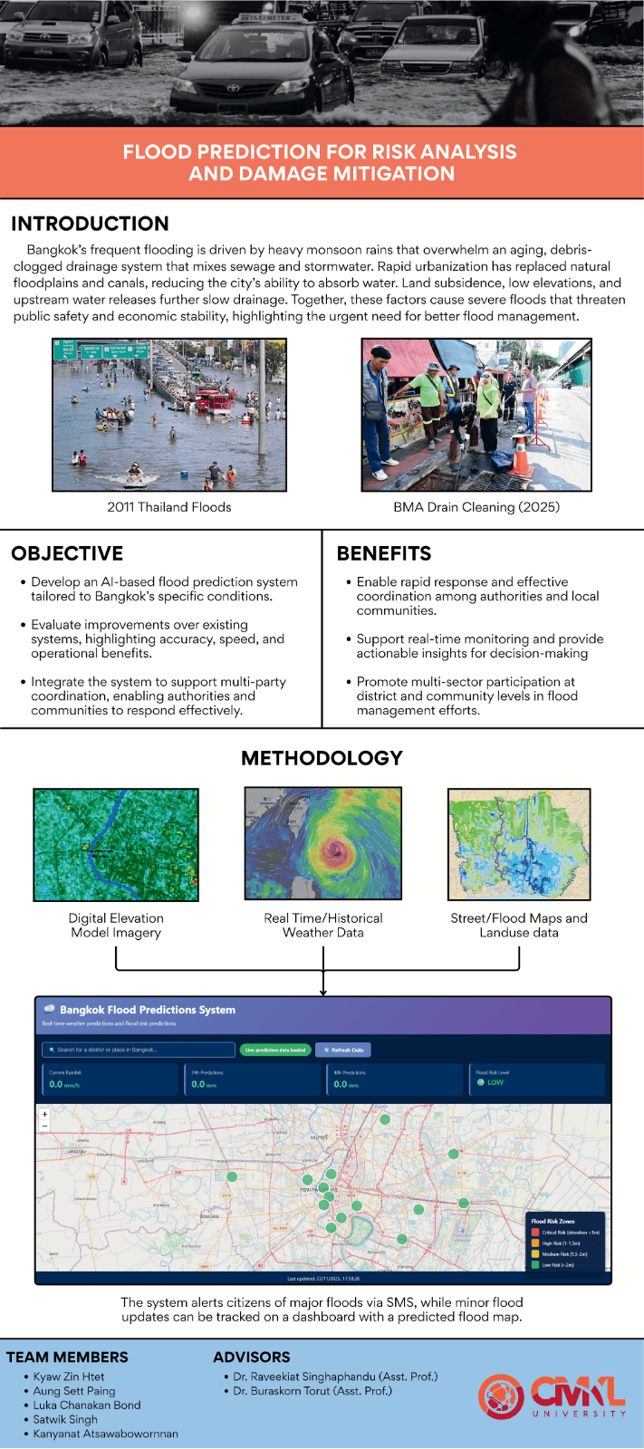
The Project Solution: Our AI-driven predictor provides short-term binary predictions (flood/no-flood) within a 24-hour window. By fusing data from radar, satellites, and rain gauges, the system serves as an early-warning tool to help the Bangkok Metropolitan Administration (BMA) allocate resources like pumps and emergency crews more effectively before water levels escalate.
Key Features
Multimodal Data Fusion: Combines satellite imagery, Digital Elevation Models (DEM), and real-time rain gauge data for a holistic view of flood risk.
Hyper-Local Focus: Unlike national models that look at large basins, this system targets street-level vulnerabilities within Bangkok’s polder (bowl-like) system.
Critical Success Index (CSI) Optimization: The model is tuned specifically to minimize "missed events," ensuring public safety is prioritized over simple accuracy percentages.
Interactive Risk Dashboard: A user-friendly interface featuring district-level risk zones, live rainfall data, and 24/48-hour predictions.
Public Alerts: Enables targeted warnings for schools, hospitals, and commuters to plan routes and protect assets.
Development and Innovation
The core innovation lies in the Hybrid AI Architecture, designed to overcome the limitations of traditional physics-based models which are often too slow for rapid urban flash floods.
The Hybrid Modeling Framework:
Spatial Module (CNN): Analyzes satellite images and terrain maps to identify natural inundation pathways and urban bottlenecks.
Temporal Module (LSTM/Transformer): Processes historical rainfall sequences to understand the delayed hydrological response of the city.
Refinement Module (XGBoost): Incorporates socio-economic data and population density to adjust the final risk score.
Technical Stack:
PyTorch: For deep learning and GPU-accelerated model training.
Pandas & NumPy: For cleaning and merging heterogeneous datasets (satellite + gauge).
Digital Elevation Models (DEM): To map the city’s 1–2 meter average elevation and predict flow accumulation.
Impact and Future Directions
Current Impact: The research has successfully identified critical data gaps, such as the "PDF Wall" (unstructured historical records) and limited access to real-time pump telemetry. By highlighting these issues, the project creates a roadmap for better data governance in Bangkok.
Future Roadmap:
Baseline Benchmarking: Validating the hybrid model against simple rainfall-threshold models to prove the value of AI.
Urban Digital Twin: Developing a virtual simulation of Bangkok’s water system to run "what-if" scenarios (e.g., simulating a 130mm "rain bomb") without real-world risk.
Real-Time API Integration: Partnering with the Thai Meteorological Department (TMD) to feed 3-hour forecasts directly into the predictive engine for live updates
.jpg)

.png)
.png)
.png)
.png)


